The results are in for the MIT Libraries’ first-ever Geospatial Data Visualization Contest! Cash prizes of $500 were awarded to one undergraduate winner and one graduate student winner.
To be eligible, posters had to include at least one map created with MIT-owned data. Entries could highlight any topic, whether it be infrastructure, public health, or ecological change. Entries were judged based on criteria including creativity of chosen topic; use of GIS in executing the project; data selection relevance to topic; documentation of workflow and analytical methods; and data visualization and effectiveness of cartographic communication.
Congratulations to the winners!
 Undergraduate Winner
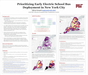
Olivia Girand, Mechanical Engineering, Urban Studies & Planning
“Prioritizing Early Electric School Bus Deployment in New York City”
Girand’s research posed the question, “Where in New York City is most suitable for early electric school bus deployment when considering environmental justice, public health, and infrastructure readiness?”
Click image to view PDF
 Graduate Student Winner
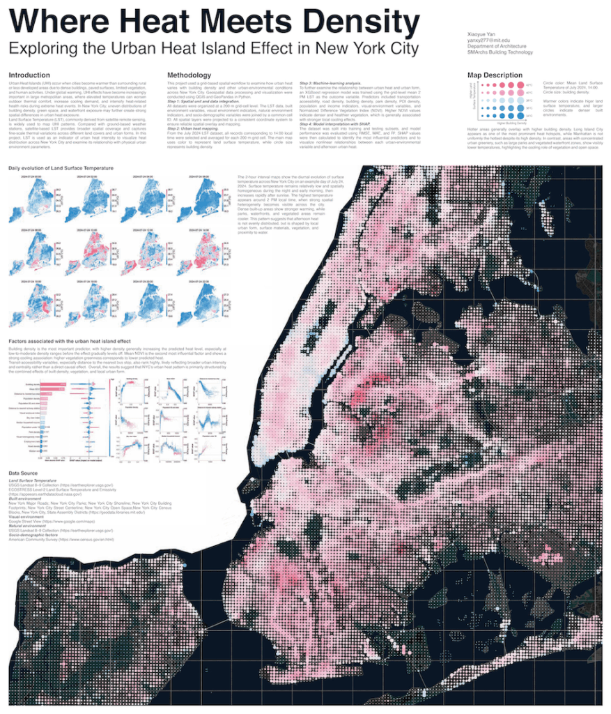
Xiaoyue Yan, Architecture
“Where Heat Meets Density: Exploring the Urban Heat Island Effect in New York City”
Urban Heat Islands occur when cities become warmer than surrounding rural or less developed areas due to dense buildings, paved surfaces, limited vegetation, and human activities. The project used Land Surface Temperature (LST), commonly derived from satellite remote sensing, as an indicator of urban heat intensity to visualize heat distribution across New York City and examine its relationship with physical urban environment parameters.
Click image to view PDF
MIT Libraries’ Data Services (Geographic Information Systems, Data Management Services, and Statistical Services) provides assistance across the Institute in data management, creation, visualization, and analysis in support of all aspects of the research, teaching, and learning workflows. Data Services experts offer support, training, and consultations both online and in person at the GIS & Data Lab, located in Rotch Library (7-238).