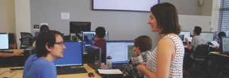
This class will introduce a variety of commonly used GIS tools, including learning to create and edit your own data, incorporate paper maps into a GIS (georeference), map tabular information (addresses and xy data – for example, from a GPS unit), change the projection of your data, calculate the straight line distance between points, create contour lines from a digital elevation model (DEM), and use ArcScene to visualize data in 3D. It is recommended for users to have done the Introduction to GIS exercise or have some previous experience with ArcGIS before attending this workshop.


